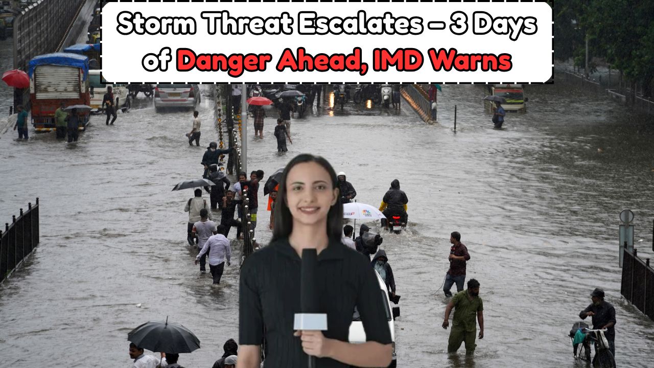
Severe Rainfall Alert – The India Meteorological Department (IMD) has issued an urgent weather advisory for several Indian states, warning of heavy to very heavy rainfall over the next three days. Accompanied by wind speeds reaching up to 70 kmph, the storms are expected to impact normal life, agricultural activity, and transportation systems. Residents in the affected areas have been urged to stay indoors, avoid travel during storm periods, and follow local administration advisories. This alert comes as a part of the monsoon’s early intensity, signaling potentially extreme weather patterns in the upcoming weeks. The IMD has specified which states are at risk and what precautions must be taken to mitigate the impact.
IMD’s Official Rainfall and Storm Warning
The India Meteorological Department (IMD) has officially issued a high-alert warning for heavy to very heavy rainfall across several regions over the next three days. Along with intense downpours, strong winds reaching up to 70 kmph and thunderstorms are expected. The IMD has advised residents and local authorities to stay prepared for possible disruptions and take necessary precautions to ensure safety.
The IMD has forecasted a combination of moderate to extremely heavy rainfall in isolated pockets. The following are the key highlights of the official alert:
- Thunderstorms with lightning expected across North, Northeast, and Coastal India.
- Wind gusts ranging from 50–70 kmph in affected zones.
- Urban flooding and waterlogging in major cities.
- Possibility of landslides in hilly regions.
- Farmers advised to take preventive steps to protect crops.
- Transport services likely to face disruptions.
States Likely to Be Affected Over the Next 3 Days
States across Eastern, Northeastern, Coastal, and Northern India are expected to face severe weather conditions over the next three days, according to the latest IMD alert. Heavy rainfall, thunderstorms, and high-velocity winds ranging from 50 to 70 kmph are likely to impact normal life. States like West Bengal, Assam, Odisha, Maharashtra, and Uttarakhand are under close watch, with varying levels of alerts issued based on predicted severity.
The table below outlines the states forecasted to experience significant impact from this storm cycle:
| State | Rainfall Intensity | Wind Speed (kmph) | Storm Duration | Alerts Issued | Cities Most Affected | Risk of Flooding | Public Advisory |
|---|---|---|---|---|---|---|---|
| West Bengal | Very Heavy | Up to 65 | 3 Days | Red | Kolkata, Siliguri | High | Avoid Travel |
| Assam | Heavy to Very Heavy | 60–70 | 2 Days | Orange | Guwahati, Dibrugarh | Medium | Stay Indoors |
| Odisha | Heavy | Up to 60 | 2 Days | Orange | Bhubaneswar, Cuttack | Medium | Secure Loose Objects |
| Maharashtra | Moderate to Heavy | Up to 55 | 3 Days | Yellow | Mumbai, Pune | High | Monitor Waterlogging |
| Uttarakhand | Moderate to Heavy | Up to 70 | 2 Days | Orange | Dehradun, Nainital | High | Landslide Alert |
| Kerala | Heavy | 50–60 | 3 Days | Yellow | Kochi, Thiruvananthapuram | Medium | Coastal Caution |
| Bihar | Heavy | 50–60 | 2 Days | Yellow | Patna, Gaya | Medium | Stay Away From Rivers |
| Meghalaya | Very Heavy | Up to 70 | 2 Days | Red | Shillong, Tura | High | Emergency Preparedness |
Impact on Daily Life and Infrastructure
The upcoming storm activity is likely to cause:
- Flooding in low-lying urban areas.
- Landslides in hilly terrains like Uttarakhand and Meghalaya.
- Power outages due to fallen trees or damaged lines.
- Suspension or delay of train and flight services.
- Road closures in heavily affected zones.
- Agricultural crop damage due to waterlogging.
IMD Recommendations for Citizens
Citizens in the forecasted regions are advised to take the following actions:
- Keep emergency kits and supplies ready.
- Stay away from open fields and isolated trees during lightning.
- Avoid travel during high-intensity rainfall periods.
- Unplug electrical appliances during heavy storms.
- Follow government updates and helplines.
Safety Precautions for Farmers and Coastal Dwellers
The IMD has released specific instructions for farmers and those living near coastal regions:
- Secure irrigation equipment and cover harvested crops.
- Avoid sowing or fertilizing in flood-prone fields.
- Tie down lightweight storage and field materials.
- Fishermen advised not to venture into the sea for the next 72 hours.
Weather Pattern Behind the Storms
Meteorologists attribute this sudden burst of rainfall and wind activity to a low-pressure area forming over the Bay of Bengal and intensifying as it moves inland. A combination of southwest monsoon dynamics and atmospheric instability has led to the current alert status.
Another table showing the movement pattern of the storm:
| Weather Pattern | Region Affected | Date of Formation | Peak Intensity | Predicted Landfall | Expected Dissipation |
|---|---|---|---|---|---|
| Low-Pressure Trough | Bay of Bengal | June 2, 2025 | Very High | Odisha Coast | June 6, 2025 |
| Cyclonic Circulation | North-East States | June 3, 2025 | High | Assam-Meghalaya Belt | June 6, 2025 |
| Western Disturbance | Northern India Hills | June 3, 2025 | Medium | Uttarakhand | June 5, 2025 |
Travel and Public Transport Updates
Several state governments and civic bodies have preemptively warned of service disruptions:
- Metro and suburban rail services in cities like Kolkata and Mumbai may face partial suspensions.
- Flights to/from Northeast India could be delayed or cancelled.
- State transport buses in Kerala and Odisha may operate on limited routes.
What to Expect Over the Next 72 Hours
Here’s a day-by-day breakdown of the expected conditions:
| Date | Region Focus | Rainfall Estimate | Wind Speed Range | Public Alert Level |
|---|---|---|---|---|
| June 3 | East, Northeast | 80-100 mm | 60–70 kmph | Orange to Red |
| June 4 | Central & Coastal | 60-90 mm | 50–60 kmph | Yellow to Orange |
| June 5 | Northern Hills | 70-120 mm | 65–70 kmph | Red |
With the IMD issuing a multi-state alert for severe rainfall and storm activity over the coming days, preparedness is key. Citizens, farmers, and urban planners are urged to heed warnings, avoid unnecessary travel, and adopt emergency protocols. Timely action can minimize property damage and safeguard lives. Weather departments will continue to monitor developments and provide real-time updates.
FAQs
1. Which states are under red alert according to the IMD?
West Bengal and Meghalaya have been placed under red alert due to forecasted very heavy rainfall and strong winds.
2. What should I do if I live in a flood-prone area?
Keep emergency kits ready, avoid going outside, move valuables to higher ground, and follow local administration instructions.
3. Are flights and trains expected to be canceled?
Yes, there may be delays or cancellations, especially in cities like Kolkata, Guwahati, and Mumbai. Travelers should check with their carriers.
4. What are the wind speeds expected during the storm?
Wind speeds are expected to range between 50 and 70 kmph in various regions, with higher gusts possible in coastal and hilly zones.
5. How can farmers prepare for the heavy rains?
Secure crops and machinery, avoid fertilizing or sowing during alerts, and stay updated through IMD bulletins and agricultural advisories.