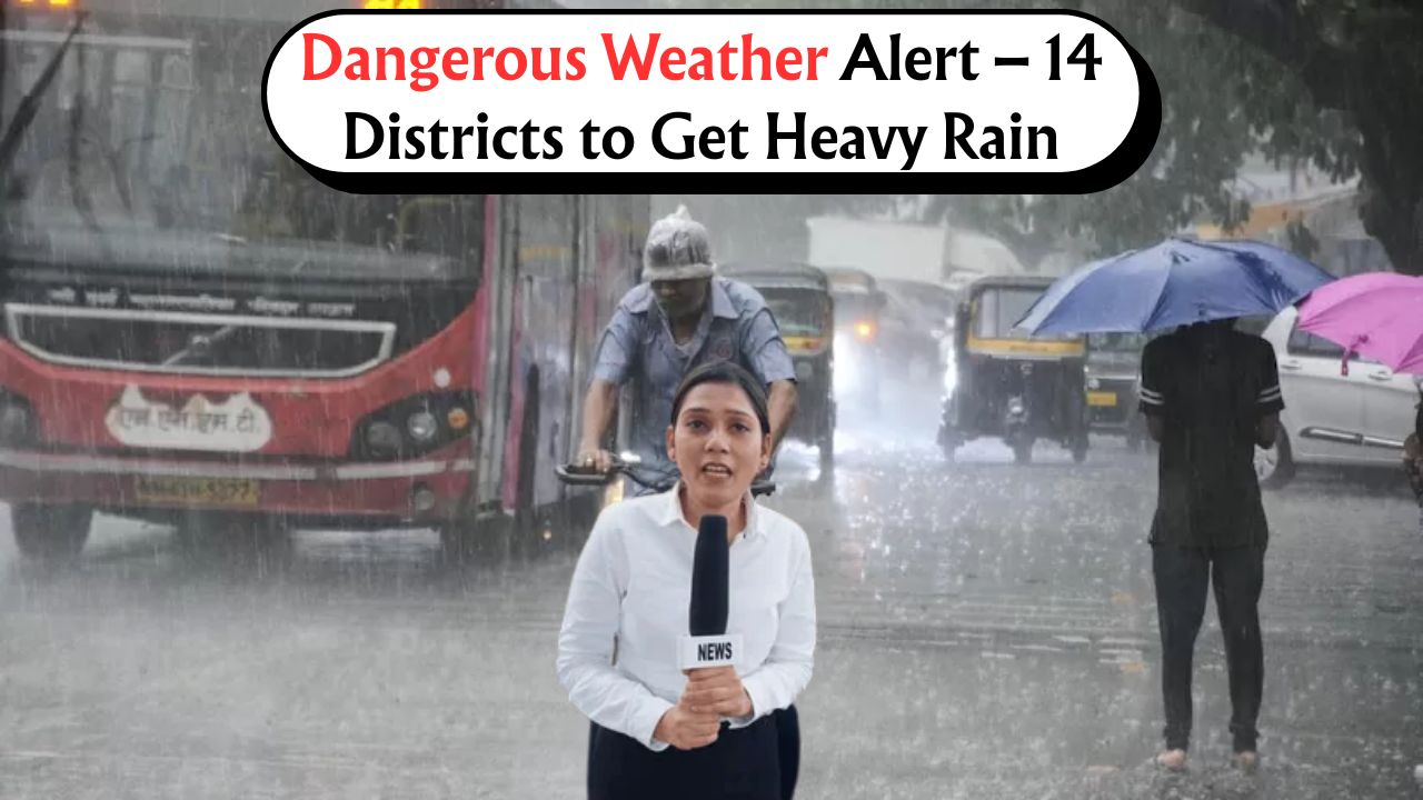
Heavy Rainfall Warning – The India Meteorological Department (IMD) has issued an urgent weather alert for heavy to very heavy rainfall across 14 districts in the next 24 hours. As the monsoon currents intensify, these regions are likely to experience severe downpours accompanied by thunderstorms and gusty winds. The alert aims to inform citizens, emergency services, and local authorities to remain vigilant and prepared for any weather-related disruptions. This article provides the full list of affected districts, the expected rainfall intensity, the timeline of impact, and safety measures recommended by the IMD. It is crucial for residents in these regions to stay updated with official alerts and take appropriate precautions.
IMD Heavy Rainfall Alert – Overview
The India Meteorological Department (IMD) has released a fresh alert warning of intense rainfall activity across several regions in the next 24 hours. This alert includes heavy to very heavy showers, thunderstorm activity, and strong winds in select districts. The purpose of the warning is to ensure timely preparedness, minimize damage, and safeguard lives as monsoon systems strengthen across the affected states. The IMD has placed several districts under a yellow and orange alert due to incoming rain-bearing systems. The following summary provides a quick glance at the overall warning.
- Alert Type: Heavy to Very Heavy Rainfall
- Issued By: India Meteorological Department (IMD)
- Duration: Next 24 hours
- Regions Affected: 14 districts across 3 states
- Potential Impact: Flooding, waterlogging, traffic disruption, and landslides in hilly areas
Full List of 14 Districts Under Rainfall Alert
The IMD has released a district-wise warning for regions expected to receive heavy to very heavy rainfall in the next 24 hours. These 14 districts span across four states and have been categorized under yellow and orange alerts based on the severity of rainfall predicted. Residents in these areas are advised to remain cautious and follow local advisories.
The following districts have been listed under the latest IMD rainfall advisory:
| State | Districts Under Alert | Alert Type | Expected Rainfall (mm) | Timing |
|---|---|---|---|---|
| Maharashtra | Pune, Nashik, Satara, Kolhapur | Orange Alert | 115 – 150 | June 4 – 5, 2025 |
| Karnataka | Udupi, Dakshina Kannada, Kodagu | Yellow Alert | 85 – 110 | June 4 – 5, 2025 |
| Kerala | Ernakulam, Idukki, Wayanad, Malappuram | Orange Alert | 120 – 160 | June 4 – 5, 2025 |
| Goa | North Goa, South Goa | Yellow Alert | 90 – 120 | June 4 – 5, 2025 |
Timeline of Rainfall Events
Here is a breakdown of the predicted intensity and timings of rainfall activity across the affected zones:
| Time Slot | Rainfall Intensity | Likely Districts Affected | Advisory Level |
|---|---|---|---|
| 6 AM – 12 PM | Moderate to Heavy | Nashik, Kodagu, Wayanad | Yellow |
| 12 PM – 6 PM | Heavy with Thunderstorms | Pune, Ernakulam, Dakshina Kannada | Orange |
| 6 PM – 12 AM | Very Heavy Rainfall | Idukki, Kolhapur, Satara | Orange |
| 12 AM – 6 AM | Intermittent Heavy Showers | Udupi, Malappuram, North Goa | Yellow |
Potential Hazards and Risk Areas
The IMD has warned of the following possible impacts in the alert regions, particularly those under orange alert:
- Localized flooding in low-lying areas
- Waterlogging on roads affecting transport and traffic
- Possibility of landslides in hilly terrains such as Kodagu and Idukki
- Disruption in electricity and mobile networks
- Risk to standing crops and agricultural fields
Safety Measures Suggested by IMD
Citizens are advised to follow these precautions during the heavy rainfall period:
- Stay indoors as much as possible during high-intensity periods
- Avoid driving through flooded streets
- Disconnect electrical appliances during lightning and thunder
- Stock up on drinking water and emergency supplies
- Keep mobile phones charged and stay tuned to weather bulletins
Authorities’ Preparedness and Emergency Contacts
Local administrations in the 14 districts have initiated pre-emptive steps to minimize rain-related damages. Emergency teams and disaster management units have been placed on standby. Below are important helpline numbers for public reference:
| Region | Emergency Helpline Number | Authority Contact |
|---|---|---|
| Maharashtra | 1077 | State Control Room |
| Karnataka | 104 | SDRF Helpline |
| Kerala | 1056 | District Collector |
| Goa | 112 | Disaster Cell |
Advisory for Farmers and Rural Communities
Heavy rainfall could potentially affect standing paddy, banana, and spice crops in Kerala and Maharashtra. Farmers are advised:
- Drain excess water from fields
- Avoid chemical spraying during forecasted rain period
- Store harvested produce in dry, safe areas
- Monitor local weather stations for updates
The next 24 hours are critical for residents and commuters in the 14 districts under the IMD’s heavy rainfall alert. Citizens are strongly encouraged to stay alert, adhere to government advisories, and prioritize safety. Continuous monitoring of official IMD updates can help mitigate the impact of severe weather conditions.
Frequently Asked Questions (FAQs)
Q1. Which states are most affected by this heavy rainfall alert?
A: Maharashtra, Kerala, Karnataka, and Goa are the most affected states with 14 districts under alert.
Q2. What does an Orange Alert from IMD mean?
A: An Orange Alert indicates very heavy rainfall and urges authorities and public to be prepared for possible emergency conditions.
Q3. What safety tips should residents follow during heavy rains?
A: Residents should avoid unnecessary travel, stay indoors during storms, and avoid contact with electrical wires and flooded areas.
Q4. Can this rainfall cause landslides or flooding?
A: Yes, especially in hilly and low-lying regions. Landslides and flash floods are likely in districts like Kodagu, Idukki, and Kolhapur.
Q5. How can citizens receive real-time updates?
A: Through the official IMD website, mobile weather apps, and announcements on TV and radio by local authorities.